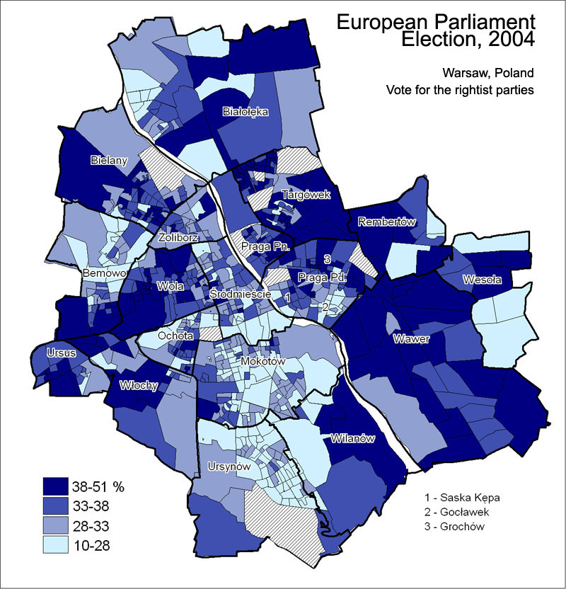
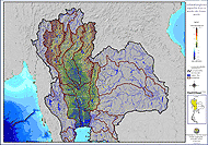
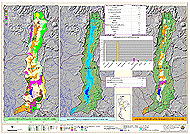
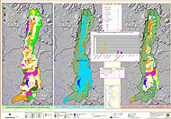
Agro-ecological zoning for the entire state of Punjab was carried out using modern tools such as remote sensing and geographical
information system. The main input parameters based on which zoning was done were annual average temperature, length of growing
period (LGP), biomass and soil texture. Initially, spatial database for temperature, LGP, biomass and soil texture were generated in GIS
domain. Thermal and LGP zones were demarcated using meteorological data of 20 stations of Punjab and its surrounding states. Then
biomass zones were derived from 10-day composite satellite data of SPOT-vegetation sensor. This zoning approach resulted into 5, 7, 3
and 9 zones for temperature, LGP, biomass and soil texture, respectively in GIS environment. Those newly drawn zones reflect that the
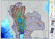
average annual temperature of the state varies from 21-26oC, with LGP ranging from < 60 to 180 days. Temperature and LGP variation in
the entire state depicted a reverse trend, having maximum temperature in south-western part with lowest LGP while lowest temperature
being recorded in the northern most parts with highest LGP. On the basis of NDVI value, the entire state was differentiated into moderate,
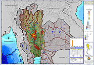
good and excellent biomass zones. Soil texture varies from fine loamy to sandy soils across the state. Overlaying of thermal and LGP
layers resulted into 7 thermal-LGP zones and when this layer was overlaid on biomass and soil textural layers in spatial domain following
logical combinations, the resultant layer was agro-ecological zones. In total 46 zones were categorized in ZBS format where Z, B and S
represented thermal-LGP, biomass and soil texture zones, respectively.